
The first cyclones of the season have formed not too far south-west of Samoa. Lucky for us (though perhaps not so lucky for those in Tonga, Niue and Wallis & Futuna) it looks like they should pass us by.
Over the last few days it's been easy to tell that something big has been brewing. It's been raining solidly for at least three days now, and the wind has been gusting harder and harder. This morning on the way to work I saw a couple of coconut trees that had snapped in half overnight. Low-lying areas have suffered some minor to moderate flooding too. At the end of the day though, we're suffering nothing more than rubbish weather. I'm sure Melbournians put up with this kind of thing all the time. ;)
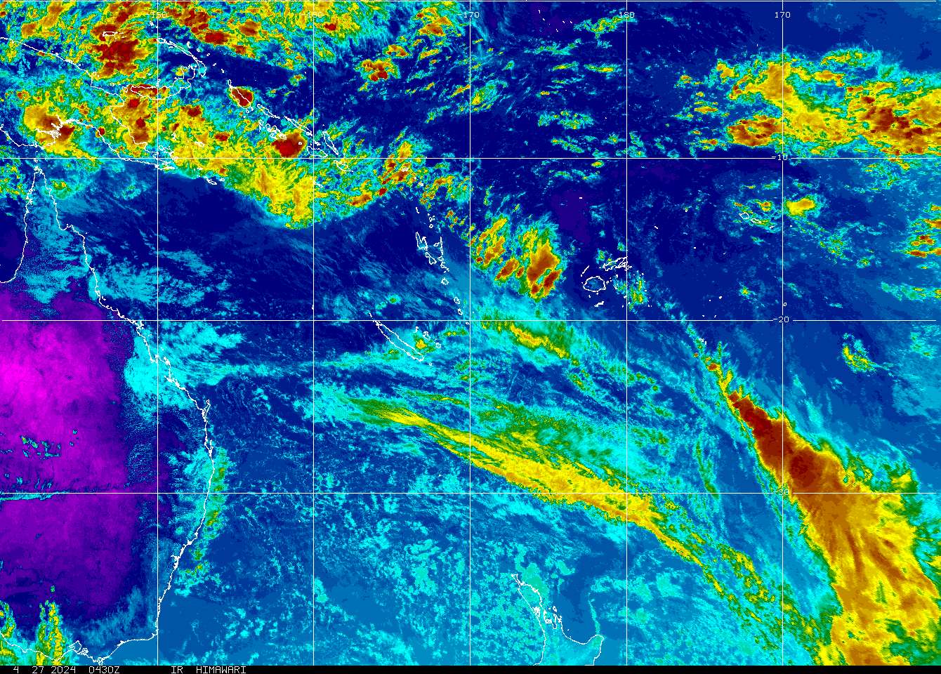
The US National Oceanic & Atmospheric Administration posts visible and infrared spectrum satellite images of the region on their website. If you have Java, you can even look at some of their satellite image loops. The image above is cropped from the coloured infrared snapshot taken at 6.30pm UMT on the 13th. You can see the outline of Samoa's two islands just above and to the right of the centre of cyclone Urmil. The Fijian island chain is in the clear to the left. Tonga, rather unfortunately, is a small white speck in the main part of the cyclone. Tropical cyclone Tam is just off the bottom of the image.
3 comments:
OK. I'm not anonymous anymore :P
You WISH you were a Melbournite buddy!
So when you and Toto are whisked away to the land of Oz, can I have all your computer-related paraphernalia?
Post a Comment